At K2sea, we develop solutions for the automation of surface vessels control and offer specialized devices, sensors and components for unmanned vessels and other automated systems. We carefully select them so that they meet the highest quality standards, while being intuitive and practical to use. We also provide operator and expert services in the selection of equipment, control, maintenance and operation of manned and unmanned vessels and related training.
Services
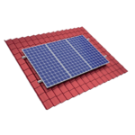
Emergency power systems and alternative energy sources
Voltage converters, energy management in emergency power systems, batteries, solar sets and accessories, professionally selected to meet the customer’s needs.
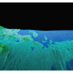
Dredging monitoring
A comprehensive offer for dredgers and dredgers, ensuring the possibility of monitoring the dredging based on the Hydromagic Dredging software.
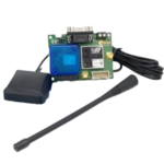
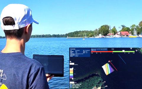
GPS RTK positioning
Devices and accessories for precise RTK positioning for agricultural machines, as well as autonomous and remote-controlled vehicles and units.
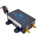
Antijamming – the GPS signal protection
Protecting the GPS signal against intentional jamming based on OtoSphere devices will ensure the safe positioning of a vehicle, drone or vessel.
Online store
The K2sea online store is the first store in Poland profiled in the construction and automation of small vessels of various types, as well as projects related to positioning and the highest quality power systems.
News
ASV mKurs delivered for the Office of Inland Navigation in Szczecin
28 December 2023
In the last weeks of the year, we delivered the ASV mKurs for the Office of Inland Navigation in Szczecin as a part of a contract to build, equip and deliver a portable autonomous surface vessel inten...Read More
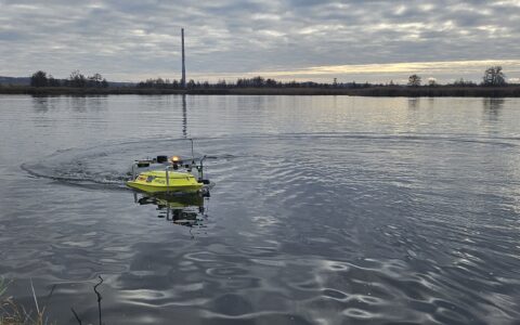
Next ASV mKurs in use
28 December 2023
ASV mKurs is operated by Szczecin-based engineering and hydrographic company ‘MATPOL Inżynieria Hydrotechniczna’. In October, MATPOL representatives could be met in Gdańsk at the BALTEXPO ...Read More
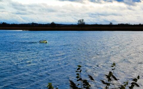
USV or ASV? Autonomy in hydrographic surveying.
26 September 2023
Uncrewed or autonomous? USV or ASV? mKurs is a surface vessel operating without a human on board – it is undoubtedly uncrewed. We talk about autonomy when a vessel “independently” de...Read More
Contact
In all matters regarding cooperation, services, training or anything you would like to talk to us, please contact us at info@k2sea.pl.
For consultancy or individual orders of the store products, please contact us at sklep@k2sea.pl.
And in every case: +48 664 027 337. We speak English. We are at your disposal from Monday to Friday, from 0900 to 1700 local time (EET).
K2sea
ul. Folwarczna 5
81-547 Gdynia, pomorskie